
Peak Names
Point your phone at the mountains and see every peak's name. Works offline.
Get it on Google Play
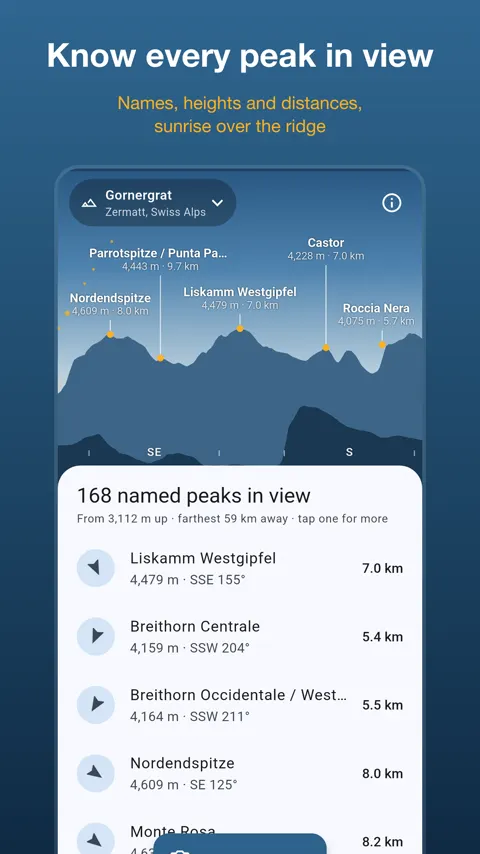
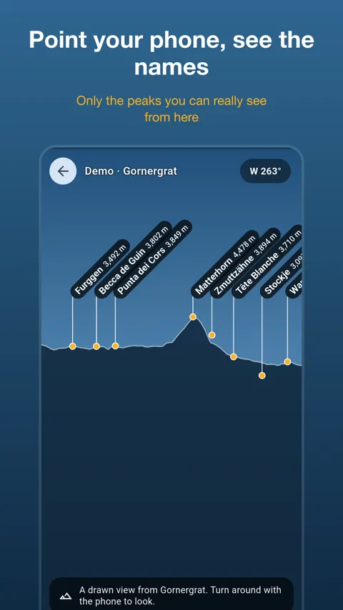
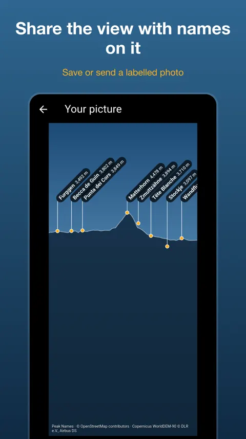
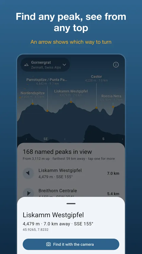
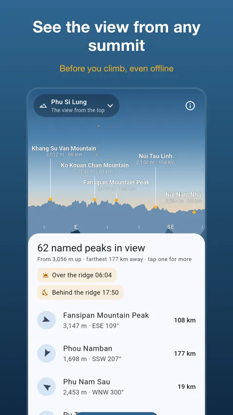
Peak Names tells you which mountain is which. Hold up your phone and the names of the peaks in front of you appear over the camera picture, with their height and distance. It is for hikers, climbers, photographers and anyone standing at a viewpoint wondering what that pointed summit is called.
Why visibility matters
A list of every summit within a radius sounds useful, but most of those peaks are behind a nearer ridge. Labels on mountains you cannot see make the picture confusing. Peak Names uses a terrain model to work out which peaks are really in your line of sight and which are hidden. The terrain has 90 m detail around you and 180 m further out, so very sharp summits come out a little low.
Reading the view
Names, heights and distances appear on the camera or on a drawn skyline. Well-known peaks come first, and you can choose Major, More or All to show fewer or more names. Turn the phone sideways for a wide panorama. If you want to read at your leisure, hold the view and lower your phone.
When the names sit beside the peaks
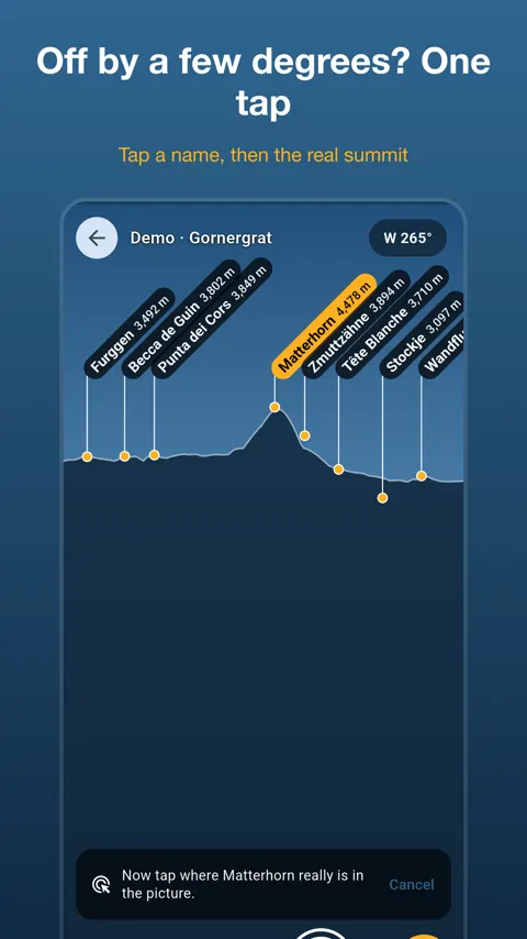
Compass error is the usual cause of labels drifting off. Instead of waving the phone around, tap a name, then tap the real summit in the picture. Everything moves into place in one step.
Finding one particular mountain
Open the list of every named summit in view, with direction and distance. Pick one and an arrow on the camera shows which way to turn. The “View from top” feature lets you see the panorama from a summit before you climb it, which is handy for deciding whether a climb is worth the effort.
Light over the ridge
Sunrise and sunset are shown over the actual mountains around you, not over a flat horizon, and the Sun’s path is drawn on the skyline. This helps when you want first light on a summit or want to know when a valley goes into shade.
Sharing and trying it out
You can take a photo with the peak names on it and save it or send it to friends. Famous viewpoints in the Alps and in Vietnam are built in, so you can try the app anywhere.
Offline, and what to keep in mind
Download an area once while you have a signal. After that, the names, the skyline and the camera view work with no connection, which is where you need them in the mountains. There is no account, no sign-in and no ads.
Accuracy depends on your phone’s compass and GPS. Peak names come from OpenStreetMap contributors, and terrain from Copernicus WorldDEM-90. If a peak has a wrong name, the developer asks you to send a note.
Does it show peaks that are hidden behind a ridge?
No. The app works out from the real terrain which summits are visible from where you stand and which are hidden, so names stay on the mountains you are looking at.
What if the names do not line up with the peaks?
Phone compasses are often off by a few degrees. Tap a name, then tap the real summit in the picture, and everything moves into place.
Does it work without a signal?
Yes. Download an area once, usually around 10 MB, and the names, skyline and camera view work with no connection.
Can I use it for navigation?
No. The app is not a navigation tool, so always carry a proper map in the mountains.